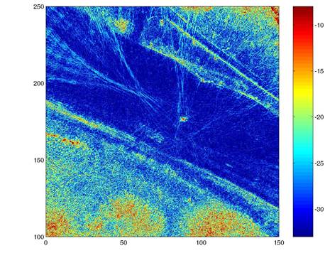
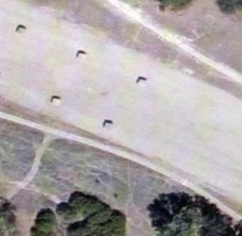
IMAGE OBTAINED USING ANACAPA IMAGING SOFTWARE SATELLITE PHOTO OF SAME AREA
A dirt
runway at Fort Hunter Liggett. Satellite picture is older than radar
image, and shows several targets which are replaced by a single target (red
dot in the center) in the radar image.
![]()
Comparison
of radar image and satellite photo