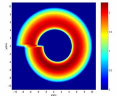
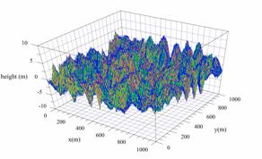
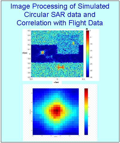
Circular SAR Simulation
Anacapa
has developed a simulation that generates random ground realizations,
simulates the trajectory and orientation of the circular SAR and calculates
simulated radar data for this complete radar scenario. The Anacapa
SAR image processing software is then used with
this data to generate simulated radar images. Finally, Anacapa developed correlation
software to apply to the in-flight radar images to aid in navigation.
![]()