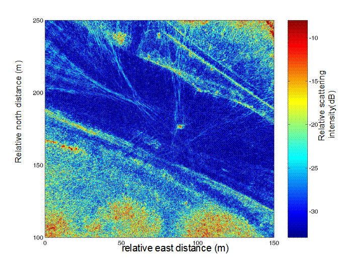
The dark blue part of the image on
the left is a dirt runway at Fort Hunter-Liggett, CA. The red dot in the
middle of the image is the calibration target.
Clusters of trees are visible (red areas)
at the lower part of the image as well as in the upper right corner.
The light blue lines over the runway
are tire tracks of the servicing vehicles.
The straight lines in the upper right
are the servicing roads.
Click here
for a comparison of the image on the left with the satellite photo of the
same area.
Click here
for photos of the radar used to take this data
![]()
